Using additional Polygons and POIs within the Simulation#
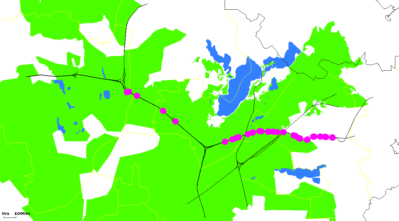
Example of using polygons and POIs; from Traffic Online, area#1

Definitions of colored polygons and POIs (points of interest) can be loaded within an additional-file. These shapes are currently meant to improve a simulation's appearance and to allow an easier debugging. No special interaction with them is implemented, yet.
Both polygons and points of interest may be located within a "layer". Shapes with lowest layer values are below those with a higher layer number. The network itself is drawn as layer 0. An additional file may contain definitions for both points of interest and polygons.
Geometrical objects may either be defined "by hand" or imported using polyconvert. A valid geometry-file can be given to sumo as one of the additional files (option: --additional-files <FILE>). For usage within sumo-gui, you have to add it to the list of additional files to load within the used configuration file or load the additional file interactively through the GUI.
Definitions#
The geometrical objects (POIs, polygons) are stored one by one into an "additional file". Currently, the root element may arbitrary.
Polygon Definitions#
A polygon is defined as following: <poly id="<POLYGON_ID>" type="<TYPENAME>" color="<COLOR>" fill="<FILL_OPTION>" layer="<LAYER_NO>" shape="<2D-POSITION>[ <2D-POSITION>]*"/>
These attributes have the following meanings:
| Attribute Name | Value Type | Description |
|---|---|---|
| id | id (string) | The id (a unique name) of the polygon |
| shape | 2D position list | The shape of the polygon |
| color | color | The RGBA color with which the polygon shall be displayed; see <COLOR> for details |
| geo | bool | Whether the shape shall be interpreted as geo-coordinates and converted |
| fill | bool | An information whether the polygon shall be filled; optional bool, default: false |
| lineWidth | double | Drawing width of unfilled polygons in m, default 1 |
| layer | float | The layer in which the polygon lies; optional |
| type | string | A typename for the polygon. |
| imgFile | string | A bitmap to use for rendering this polygon |
| angle | float | angle of rendered image in degree |
POI (Point of interest) Definitions#
A point-of-interest is defined as following: <poi id="<POLYGON_ID>" type="<TYPENAME>" color="<RED>,<GREEN>,<BLUE>" layer="<LAYER_NO>" [(x="<X_POS>" y="<Y_POS>") | (lane="<LANE_ID>" pos="<LANE_POS>")]/>
It means that the position a point-of-interest is located at may be given either using explicit x/y-coordinates or a lane name and a position on this lane. So, the attributes have the following meanings:
| Attribute Name | Value Type | Description |
|---|---|---|
| id | id (string) | The id (a unique name) of the polygon |
| color | color | The color with which the poi shall be displayed; <RED>, <GREEN>, and <BLUE> must be floating point numbers between 0 and 1. They are divided using a ',' (no space); optional, default "1,0,0" |
| x(*) | float | The position of the poi along the x-axis in meters |
| y(*) | float | The position of the poi along the y-axis in meters |
| lane(*) | id (string) | The name of the lane the poi is located at; the lane must be a part of the loaded network |
| pos(*) | float | The position on the named lane at which the poi is located at |
| posLat(*) | float | The lateral offset on the named lane at which the poi is located at (negative values lie on the right side of the lane center line in driving direction) |
| lon(*) | float | The geo-position of the poi along the east-west axis in degrees |
| lat(*) | float | The geo-position of the poi along the north-south axis in degrees |
| type | string | A typename for the poi. |
| layer | float | the layer of the poi for drawing and selecting. |
| imgFile | string | A bitmap to use for rendering this poi. If none is given, circle is drawn instead. The bitmap is tinted by the given color unless for white ("1,1,1"). |
| width | float | width of rendered image in meters, diameter of the POI when not loading an image |
| height | float | height of rendered image in meters |
| angle | float | angle of rendered image in degree |
(*) Either x/y or lane/pos or lon/lat must be given
Note
When specifying the attributes lane, pos and posLat, they are automatically added as generic parameters accessible via TraCI.
See Also#
- See the description of polyconvert in order to know how polygons/POIs can be imported from other sources
- Developer/Implementation Notes/Drawing in sumo-gui describes how sumo-gui renders loaded structures (for developers)
- You can read variables of loaded PoIs and read variables of loaded polygons via TraCI
- You can add PoIs and manipulate their properties and the same for polygons via TraCI

